

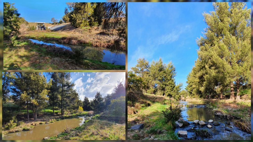
For my work experience, I headed out to Bonshaw and Jerrabomberra East Grasslands in Canberra to continue undertaking long-term reptile surveys guided by ACT Parks & Conservation. These surveys aim to investigate the population dynamics of nationally vulnerable listed species[1] [2], the Striped Legless Lizard (Delma impar) – and their relation to habitat condition influenced through differing management strategies. I learned a whole lot about these lizards – but also, their seemingly controversial management.
Why?
Striped Legless Lizards (Delma impar) resemble exactly what their name suggests – lizards, without legs, that are (generally[3]) striped. Endemic to south-eastern Australia; over 90% of their natural temperate grassland habitats have been cleared. This is largely due to urbanisation, but also to the agricultural desirability of natural grasslands.[4]
Aggravating this situation is that most of the remaining, fragmented 10% of natural grasslands in south-east Australia are subject to grazing. Regardless of whether grazing is by native kangaroos or through introduced stock pasture, research has shown that grazing at amplified levels disturbs the preferred ecological niche of Striped Legless Lizards: well-developed but structurally complex grass thatch swards, with tussock height between 20-50cm.[5]

Is this not a high maintenance lizard? Wouldn’t triaging the species be a better trade-off?
Like any threatened, vulnerable or endangered species: perhaps. There are more common lizards in these ecosystems which can do their job. At this point, conserving Delma impar is a valuable insurance policy in favour of the overarching ecosystem by the means of species diversity.
Moreover, the environment will always require “maintenance”. Indigenous peoples have recognised the importance of biodiversity and have managed country for thousands of years to support it – through cultural burns[6], selective harvest[7] [8] and seasonal monitoring[9]. Ecologist Brett Howland notes:
“You can’t lock a reserve up and throw away the key – that doesn’t work.”[10]

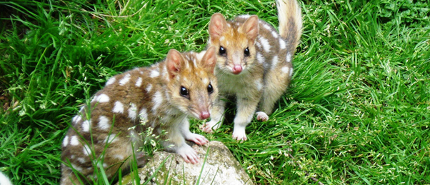
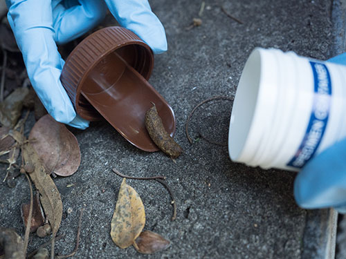
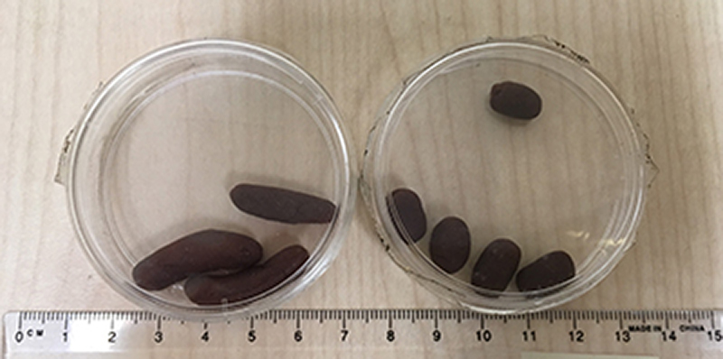
While we did not find any Striped Legless Lizards – we were lucky enough to see a Grassland Earless Dragon! (a nationally endangered species). Pictured is Thea handling the lizard (with training and approval! – note it is illegal for the general public to handle wildlife). 
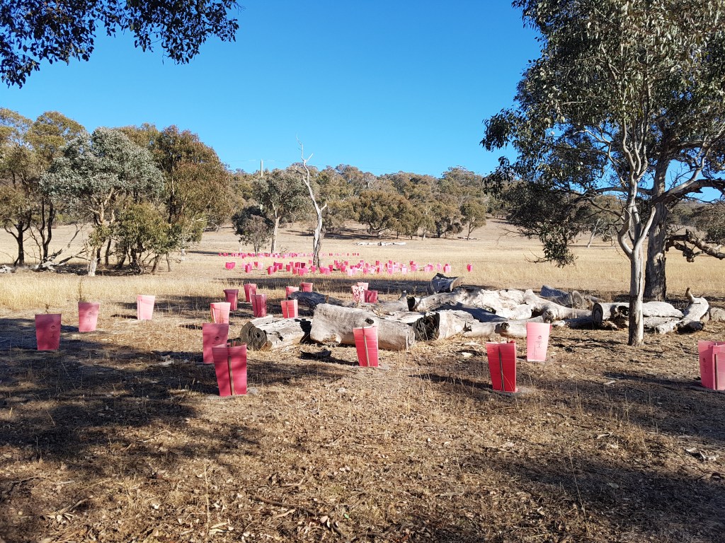
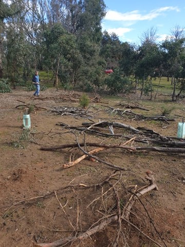
Example of the arrangement of one subplot of tiles that were flipped to record lizard species around the sites. Source: Thea O’Loughlin
Cattle – Controversial management at Bonshaw and Jerrabomberra
Jerrabomberra and Bonshaw grasslands have been subject to community backlash in past leaseholds for kangaroo culling (as a form of overgrazing management), and are now, under Parks & Conservation[11][12]. This management decision is relevant to the Striped Legless Lizard as while it is important to maintain grass cover for them and therefore reduce grazing, as noted earlier, maintaining structural complexity (mixed length grass tussocks) is also integral. This means grazing cannot be entirely removed– rather, it must be intermittently retained.[13]
Considering this, it was to my surprise when I found out that both reserves still utilise cattle grazing, but cull kangaroos. Why cull kangaroos and retain cattle when the latter are considered a more destructive grazing mammal?[14]
My guide for the day, Thea, pointed to the pro’s and cons. More relevant to Delma impar was that the weed, serrated tussock, is particularly unpalatable to cattle – and as such can actually function as a temporary surrogate habitat shelter for the lizards[15]. Additionally, whilst maintaining community engagement (i.e. with the previous agisters), cattle also have temporary benefits of removing phosphorus (problematic to native plants[16] and remanent from previous exotic pasture fertilisers) from the landscape more so than kangaroos, as they are removed from, rather than returned to the system when agistment ends.
Conclusion
This experience reinforced how effective biodiversity conservation can be a complicated process, and consequently, might require a shift in perspective from a traditional lens. It also gave me the opportunity to learn more about Delma impar conservation efforts in Canberra.
Acknowledgements
Thank you, Thea, for sharing your extensive knowledge with me – and Phil, for facilitating this work experience opportunity.
Olivia Torresan
u6380380
References:
[1] Australian Government Department of Agriculture, Water and the Environment. n.d. EPBC Act List of Threatened Fauna, Australia. Accessed 9th September, 2020.
[2] Australian Government, Department of Agriculture, Water and the Environment. EPBC Act – Referral guidelines for the vulnerable striped legless lizard, Delma impair. Australia. Accessed 9th September, 2020.
[3] ACT Government, Environment, Planning and Sustainable Development Directorate, Striped Legless Lizard, Delma impar Action Plan. Australia. Accessed 9th September, 2020.
[4] ACT Government, Environment, Planning and Sustainable Development Directorate, Natural Temperate Grassland Endangered Ecological Community Action Plan. Australia. Accessed 9th September, 2020.
[5] See 3.
[6] Fletcher, M.S & Thomas, I. 2010. “The origin and temporal development of an ancient cultural landscape”, Journal of Biogeography, vol. 37, no.11. pp. 2183-2196.
[7] Commonwealth Scientific and Industrial Research Organisation (CSIRO). n.d. About the Indigenous seasons calendars. Australia. Accessed 9th September, 2020.
[8] Leonard, S., Parsons, M., Olawsky, K. & Kofod, F. 2013. “The role of culture and traditional knowledge in climate change adaptation: Insights from East Kimberley, Australia”, Global environmental change, vol. 23, no. 3, pp. 623-632
[9] See 7.
[10] Australian National University (ANU) College of Science. n.d. Kangaroos Eating Reptiles out of House and Home. Australia. Accessed 9th September, 2020.
[11] Mcillroy, T. 2014. Vandals target Canberra kangaroo cull site at Jerrabomberra Grassland West Nature Reserve, Canberra Times. Accessed 9th September, 2020.
[12] Australian Wildlife Protection Council (AWPC). 2017. “Brutal ‘Conservation Cull’ of ACT Kangaroos – Carnage Wrapped in Environmental Language!”, Australia. Accessed 9th September, 2020.
[13] See 3.
[14] Grigg, G. 2002. Conservation benefit from harvesting kangaroos: status report at the start of a new millennium: a paper to stimulate discussion and research, University of Queensland Department of Zoology and Entomology, Australia. Accessed 9th September, 2020.
[15] See 3.
[16] Lambers, H., Ahmedi, I., Berkowitz, O., Dunne, C., Finnegan, P.M., Hardy, Giles E. St J, Jost, R., Laliberté, E., Pearse, S.J. & Teste, F.P. 2013. “Phosphorus nutrition of phosphorus-sensitive Australian native plants: threats to plant communities in a global biodiversity hotspot”, Conservation Physiology, vol. 1, no. 1, pp. 1-14.


