
By Catherine Gray (u6679765)
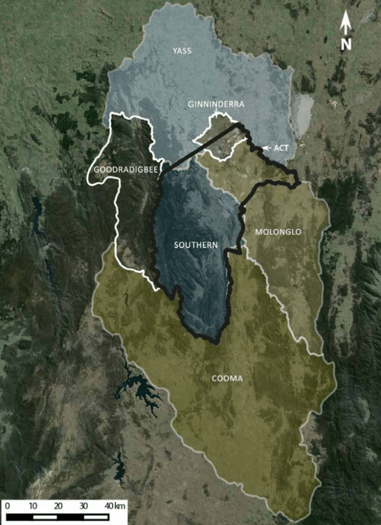
Stretching over 84,000 square kilometres, across the southern regions of NSW and the ACT, lies the Murrumbidgee catchment. An incredibly diverse landscape containing nationally significant ecosystems and unique biodiversity.
“A catchment is an area where water is collected by the natural landscape. Imagine cupping your hands in a downpour of rain and collecting water in them. Your hands have become a catchment.”
Water NSW

Urbanisation and Water Quality
Urban environments are known to decrease water quality through various means, including…
- Altered infiltration, evapotranspiration, and runoff. Due to an increase of hard surfaces and decrease of permeable green spaces.
- Increased sediment, due to previous landscape changes.
- Introduced pollutants and contaminants.
- Altered flow, due to the implementation of weirs, dams, etc.
Canberra is located within the upper region of the Murrumbidgee catchment, where waters are exposed to the effects of an urbanised landscape. Several threatened aquatic species are found within the ACT, and rely on healthy waterways. Including the Murray cod (EPBC Status: Vulnerable), Trout cod (EPBC Status: Endangered), the Murray River crayfish, and more.
Waterwatch: A Citizen Science Project
Over the past year and a half, I have volunteered for Waterwatch. A national citizen science project with three aims.
1. To engage the community in the environment through monitoring and caring for our catchments.
2. To educate and raise awareness in schools and the community on issues concerning catchment health.
3. To use data collected by volunteers to inform policy and on ground catchment management.
Waterwatch ACT
ACT Waterwatch (also known as Upper Murrumbidgee Waterwatch) monitors several sub-catchments in and around Canberra.
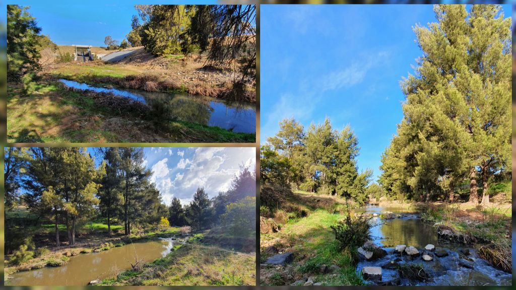
Volunteers monitor sites monthly and record key water quality data. The data is compiled to create the Catchment Health Indicator Program Report, more commonly known as the CHIP Report. This report provides insight into the health of the sub-catchments, and is used to inform policy and management within the region.
Over my time with Waterwatch, I monitored three sites over two sub-catchments.
Southern Sub-Catchment
Within the southern sub-catchment, I monitored the water leaving Lake Tuggeranong. A lake containing several native fish species, including the golden perch and vulnerable Murray cod.
Ginninderra Sub-Catchment
I monitored two sites within the Ginninderra sub-catchment. Including a site located after a pollutant trap (providing insight into the urban impacts on water quality), and a second site following a conservation location (providing insight into the water quality within the conservation area).


Importance of Waterwatch
Waterwatch is an incredibly valuable program. Providing community engagement, creating positive changes within policy and water management, and encouraging healthier waterways to support local biodiversity.
Acknowledgements
A big thank you to Martin and Bruno for the opportunity to volunteer with Waterwatch over the past year and a half!

