Arrested Development: Protecting Canberra’s Endangered Species.

In my experience of biodiversity conservation, I’ve taken first and foremost that it is never as easy as it sounds. While a huge amount of work goes into field work and understanding the landscape ecology of an area, an equal amount goes into arguing and fighting back and forth between an eclectic mix of people and organisations. What I wanted to gain from my experience was an understanding of the behind-the-scenes workings of real-world scenarios on a local scale, and where better to do that than at the Conservation Council ACT region (http://conservationcouncil.org.au/ ). As they say:

“We are the voice for the environment representing community environmental and sustainability groups in the ACT region.”

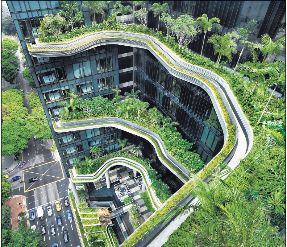
I also got to do a lot of my word in a pretty hip office!

cocoloho

My supervisor on the project, Larry O’Loughlen (far left) and Claire Henderson the executive director (second left)

The Project

As a work experience researcher I was asked by my supervisor, Larry O’Loughlen, to delve into attitudes towards the use of nature. This idea was based on areas such as recreation areas in national parks and tossing around the ideas of “too much” and overusing land which is dedicated for us humans to get our dose of nature. I was lucky enough to attend a symposium on the Riverview development project in west Belconnen that crosses the NSW border. Present were people from the Riverview Development Company, professors, species specialists, representatives of the Gininderra Falls Association, Frank Fenner Association and many other associated professionals.

frankfenner

Professor Stephen Boyden spoke passionately about the reserves the Frank Fenner Association had regarding the development, it was fascinating to hear him speak.

riverview

The Riverview Group are a distant branch of the federal government responsible for urban development throughout ACT and NSW

The Symposium

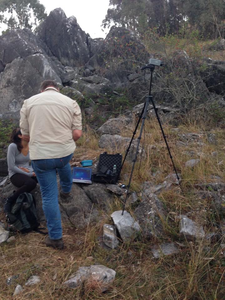
The experience of watching a series of suggestions, justifications and scrutinies from such a broad range of people, all with different goals and passions on a development was almost surreal – this wasn’t a classroom stimulated discussion where you were allocated a position and told to argue it, this was an actual discussion about the fate of species, habitat corridors, conservation borders, biosensitivity (a new term coined and discussed by Professor Stephen Boyden) and contingency. From this I realised that there are so many people to win over and convince in order to even begin thinking about developments in such a rich ecosystem. The system itself holds many key species such as the Pink Tailed Worm-Lizard and Golden Sun Moths, but also Box Gum Woodland.

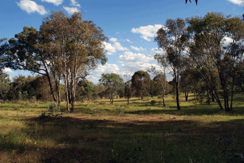
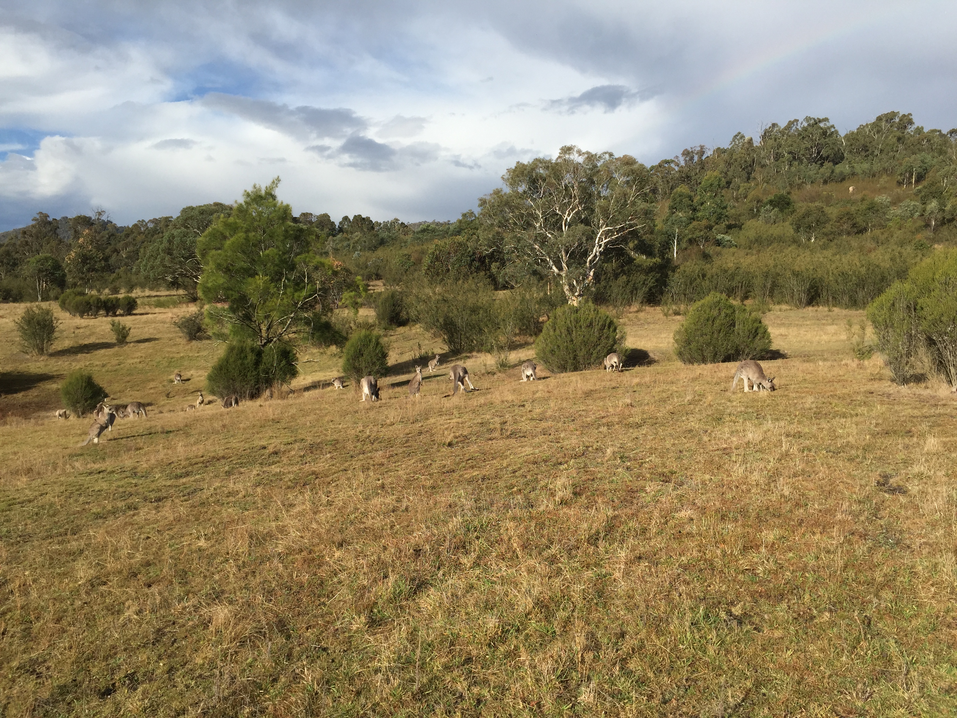
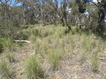
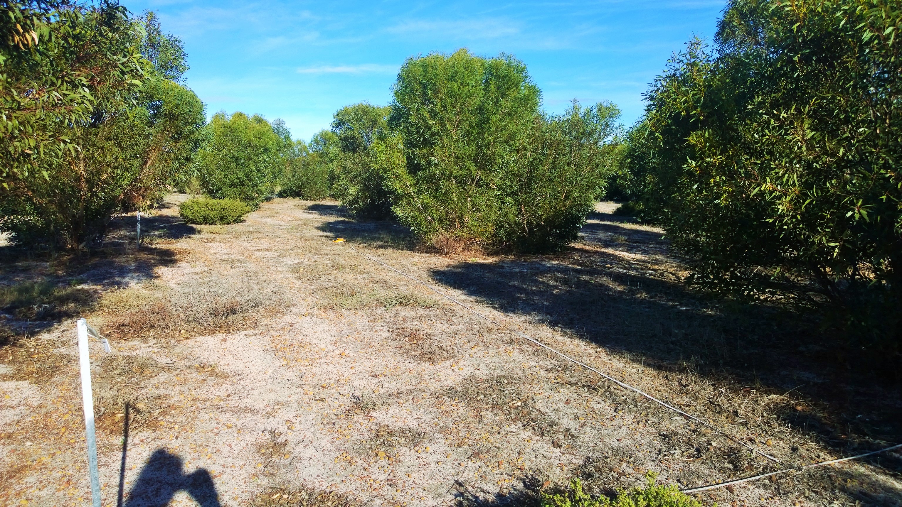
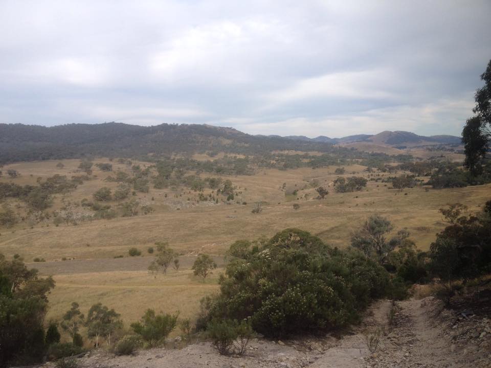
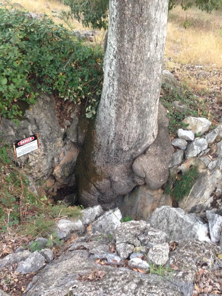
Part of the Box Gum Woodland in West Belconnen

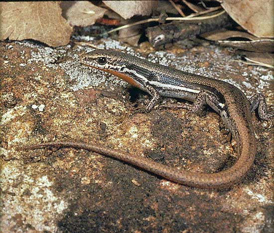
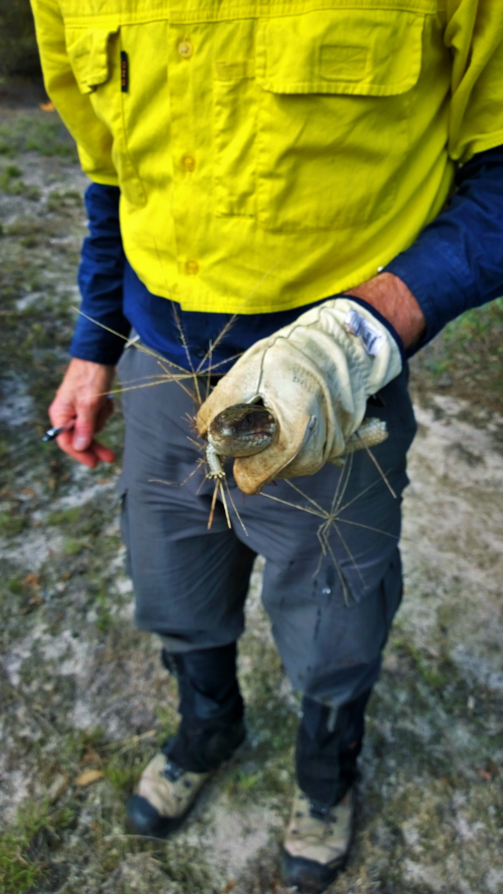
Canberra’s Pink Tailed Worm-Lizard, they’re only known habitat is in the area posed to be developed.

The Golden Sun Moth, a rare species of moth restricted mostly the patches of the ACT and rural NSW

PROP

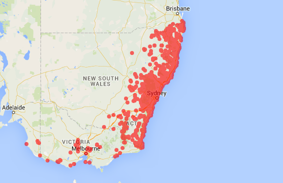
A map from the Ginninderra Falls Association showing proximity to the falls and box gum woodland with the proposed development

Understanding

In the symposium, and amongst the research I conducted on behalf of the Conservation Council, I found that one of the most important inputs came from the community. The community who are living there will be the people impacted the most, and next to indigenous knowledge (http://researchonline.jcu.edu.au/22707/), understand the land they’ve been living on the best. On a local scale, their engagement means a lot of the nitty gritty facts are picked up on and adhered to by developers, and on a global scale – a community opinion by sheer quantity can hold more gravity than the opinion of others and can often be the key to compromise, which I saw at this meeting and have no doubt, is present in bigger decisions having bigger impacts  (http://link.springer.com/article/10.1007/s10551-009-0360-1)

Conclusions

The study of urban expansion encompasses a broad range of people, and is in ongoing conflict with biodiversity specialists. In this field, I feel the wisdom that has been imparted on me in my time at the Conservation Council is that negotiation is imperative and middle ground (pun intended) is invaluable when balancing biodiversity, ecology and human expansion. There is still plenty of room to improve and progress in this area and I think there’s a lot more in store for West Belconnen, and the globe in terms of vicariously balancing conservation  and expansion. If you’re interested in more on this topic, my research will be published on the Conservation Council website, facebook and twitter in upcoming weeks regarding attitudes to nature and what needs to change – so stay tuned!

u5177151

Posted in Uncategorized | 1 Comment

LEAF + LUSH = BiodiverCity?

When we think about biodiversity, we have some pre-set ideas in our minds of dense rainforests, native grasslands and other pristine landscapes. But what about cities?

Biodiversity in pristine landscapes (Croatia’s Plitvice Lakes National Park) or in cities (Dubai)? (Credits: Vedrana Tafra & Franck Boutonnet)

Biodiversity in pristine landscapes (Croatia’s Plitvice Lakes National Park) or in cities (Dubai)? (Credits: Vedrana Tafra & Franck Boutonnet)

Given that urban areas are growing, it is important to start thinking about biodiversity within cities or more fondly known as concrete jungles. How can we increase biodiversity within the constraints of an urban setting? Perhaps we can look at the City in a Garden[1], Singapore and her two new initiatives, LEAF and LUSH and see if we can draw anything from them.

Landscape Excellence Assessment Framework (LEAF) [2]

LEAF- certified Outstanding Project: ADANA @ Thomson (Condominium) (Credits: NParks, 2014)

LEAF- certified Outstanding Project: ADANA @ Thomson (Condominium) (Credits: NParks, 2014)

What: Award scheme valid for three years.
When: Launched in 2013.
Why: Encourage developments to uphold a high standard of ecological provision and management for both new and existing developments.

Assessment Criteria for LEAF (Credits: CUGE, 2014)

Assessment Criteria for LEAF (Credits: CUGE, 2014)

Landscaping for Urban Spaces and High-Rises (LUSH)[3]

Parkroyal at Pickering (Hotel) under the LUSH scheme (Credits: Patrick Bingham-Hall)

Parkroyal at Pickering (Hotel) under the LUSH scheme (Credits: Patrick Bingham-Hall)

What: Part of the planning regulation for mandatory landscape replacement in new and redevelopment projects within designated zones comprising of downtown central areas, certain growth areas and town centres[4].
When: Launched in 2009, upgraded to Version2.0 in 2014.
Why: Encourage and facilitate pervasive urban greenery that is accessible so as to improve overall living and working environment.

Concept of landscape replacement of LUSH (Credits: URA, 2014)

Concept of landscape replacement of LUSH (Credits: URA, 2014)

Under fire?

Here is what the critics might say:

“LEAF is only appealing to developers if green developments are appealing to consumers!”
“Developers are only interested in using LEAF to increase selling prices of their developments.”
“LEAF may not have long term effect as there is minimal incentives to renew applications or keep up with efforts once the development has been sold or after it expires after three years.”
“Will LUSH and its high-rise greenery attract birds and lead to increased bird collision and mortality[5], [6]?”
“Is LUSH an onsite offset initiative in disguise but without the principles of equivalence and additionality ingrained?”

But before you throw LEAF and LUSH into the fire pit, read on..

Increasing BiodiverCity?

Take a closer look. LEAF and LUSH are actually complementary. LEAF places more emphasis on the quality and ecological role of greenery, whereas LUSH is more concerned about the basic quantity of greenery to be replaced. It is like playing Lego, where LUSH is the foundation with LEAF stacking above, making the blocks taller. LEAF also functions more like a carrot (incentive) and LUSH, being mandatory, like a stick (regulatory).

In addition, if we look beyond the two initiatives and at the context in which it sits, we will find LEAF and LUSH takes on the role of encouraging private sector involvement in biodiversity measures where current initiatives are mostly public sector projects.

Examples of public sector projects include the Park Connector Network[7] and Nature Ways[8] that aim to increase connectivity between Nature Reserves and urban parks.

Nature Way along public roads (Credits: NParks, 2015)

Nature Way along public roads (Credits: NParks, 2015)

Public flats which houses more than 80% of the locals [9] have also included ‘eco’ features in their new developments, bringing biodiversity even closer to the people.

Example of eco features in new HDB estate at Tampines (Credit: HDB, 2014)

Example of eco features in new HDB estate at Tampines (Credit: HDB, 2014)

To sum up, LEAF and LUSH may not be perfect. But given that they complement each other and other public sector projects, perhaps the whole is greater than the sum of its parts.

To leave you with more food for thought, how does all these measures fit into the concept of a biophilic city[10]? Is a biophilic city the way forward?

U5523143

Posted in biodiversity conservation | Tagged , , , , , , , | 2 Comments

Rabbit control: Protecting Canberra’s Nature Reserves

U5196579

Rabbit pest problem in Australia

Everybody knows the European rabbit (Oryctolagus cuniculus) is an invasive pest in Australia. Overgrazing affects growth of native plants exposing top soil, causing erosion and rabbits compete with native fauna for resources.
Rabbits can survive in a wide range of landscapes, such as grasslands, woodland, heath and forest, all of which are found in Tidbinbilla Nature Reserve (TNR) and in places, they can be found in very large numbers.

Even though I knew all this, admittedly, it was not until starting work at TNR that I realised the extent of the problem. My opinion now? Kill ‘em all.

Grassland at Flints (TNR), perfectly suitable for rabbit (and kangaroo) grazing

Grassland at Flints (TNR), perfectly suitable for rabbit (and kangaroo) grazing

TNR have a number of programs aimed at increasing populations of threatened species including Yellow-footed Rock-wallaby (Petrogale xanthopus) Southern Brush-tailed Rock-wallaby (Petrogale penicillata), and Eastern Bettong (Bettongia gaimardi) whose diets overlap with rabbits. For all of the reasons mentioned above, it is important to have a good plan.

My Work

My first day I was shown around the park to familiarise myself. Ranger Jackson and I looked for recent rabbit activity in areas treated with 1080 poison a couple of weeks prior as part of an initial reduction plan.

I was tasked with using a GPS system to map any warrens and activity throughout selected parts of the reserve. These included the popular walking areas of Black Flats, The Sanctuary, Flints picnic area, Rock Valley Homestead surrounds and Bushland Meander. GPS points included notes if warrens, latrines and scratchings were present.

IMG_1175

Rabbit warren entrances under old Eucalyptus stump


The data were used to create maps necessary for the second component of the park’s plan in releasing calicivirus (Rabbit haemorrhagic disease). This is a preferred method in rabbit control as it is rabbit specific, unlike 1080 poison which can affect a number of species. Calicivirus is transferred by direct contact and flies are also key transmitters, so the release will commence as the weather warms again and fly numbers increase.

After looking at sites with lot’s of activity, we mapped out which areas would be most successful in encouraging the spread and where cages should lay.

The idea is to have a couple of free feeds (not infected) to attract the animals to caged areas where a third feed will contain the calicivirus. The maps created from GPS data will help in monitoring areas for further treatment and for any necessary carcass collection after the virus release.  

Rabbit before feed containing virus (Picture credit http://www.pic2fly.com)

Rabbit after feed containing virus (Picture credit http://www.cartoonsimages.com)

Conclusion/Reflection

Obviously rabbit pest management is an ongoing battle but hopefully the data collected and the project that is being undertaken can help in reducing the effects and assist with future enclosure and animal release planning for natives.

Being outside in breathtaking scenery daily was surreal and I found it more to be a privilege for myself rather than work.

DSC01153

View from the top of Gibraltar rocks, Tidbinbilla Nature Reserve

I spent five days at TNR and had the opportunity to learn and be part of a variety of projects the staff are involved in.
It was a great learning experience to see the variety of work that takes place at Tidbinbilla and to gain a better understanding of pest management in different landscapes in our Bush capital.

Posted in Volunteer work | 1 Comment

Rehabilitation: who’s ready for long-term commitment?

U5235837

Box – Gum Grassy Woodland is recognised as nationally critically endangered under the Environment Protection and Biodiversity Conservation (EPBC) Act 1999. This class of ecological community supports a diverse mix of Yellow Box and Blakely’s Red Gum trees, native tussock grasses, herbs and shrubs that support faunal communities such as the Brown treecreeper (Climacteris picumnus) and the endangered Golden sun moth (Synemon plana).

Did you know that the Australian Capital Territory (ACT) is home to the largest remnant Box – Gum Grassy Woodland in good condition? This is likely due to the short-termed leasehold titles that had previously been issued by the government in the 1950s, which discouraged intensive pasture improvement that was occurring in other states. Overgrazing, weed invasion and soil acidification are but some of the causes behind the disappearance of Box – Gum Grassy Woodland habitats across Australian landscapes.

What awaits the fate of clapped out landscapes?

IMG_4661-2

Enter Bush Heritage Australia, which acquired 1328 hectares of degraded property in Scottsdale Reserve, 75km south of Canberra. Since 2006, 300 hectares of this ex-agricultural land had undergone restoration (through community plantings and monitoring) through Greening Australia. Part of the conservation goals for this land is research to better understand the dynamics behind ecosystem restoration. 

Work experience

jamie

(Mythbusters, Discovery Channel)

What do bombs, beer-making and ecological restoration have in common? Without data capture and analysis, these would have had less success in their intended goals through poor decision-making processes.

For my work experience, two students and myself, under the guidance of Dr. David Freudenberger, spent a day at Scottsdale Reserve. Monitoring was the order of the day, with pen, paper, measuring tape, cameras and eyeballing our tools of the trade.

IMG_4653-2In past years, batches of students and volunteers have planted saplings and seedlings upon rows within the 300ha site by hand or direct seeder machines. Our role was to check on these saplings from Eucalyptus, Acacia, Cassinia and Bursaria genera, categorising these plantings according to soil type, genus/species and health. Some rows had differing treatment (weed mats), while others had specified patterns of species planted along the row. From our data collection exercise, we were able to confirm low plant mortality rates (less than 4%) over two years.

At this stage of the monitoring process, plant condition and survival are crucial variables. In future, as these plants establish, it becomes feasible to incorporate monitoring of more than these variables – such as soil chemistry, the presence of diseases, or faunal surveys. At the core of habitat restoration is the importance of having rehabilitation sites focused on conservation, free from the pressures of agricultural and developmental use.

OLYMPUS DIGITAL CAMERA

With an ever-growing pool of volunteers numbering more than 20,000, the viability of large-scale and long-term restoration operations appears to be secure, but effective management remains the key driver for success. Through this experience, I have learned that the use of volunteers is a double-edged sword – high enthusiasm and energy to do the tedious work is, more often than not, paired with low experience to accomplish the task at hand. It is likely that first-timers like myself contributed to low data accuracy.

Nevertheless, with NGOs like Bush Heritage doing their bid to secure more potential land for rehabilitation, a future with more robust and resilient native habitats is ever closer towards realisation.


Links for further reading

Scottsdale Reserve (Bush Heritage) – http://www.bushheritage.org.au/places-we-protect/new-south-wales/scottsdale

Description and advice to the Minister for the Environment and Heritage on Box – Gum Grassy Woodland under the EPBC Act –http://www.environment.gov.au/biodiversity/threatened/communities/pubs/box-gum.pdf

Posted in Uncategorized | 1 Comment

Animal Movement through Box Gum Woodlands

Fiona Backhouse, u5175017

Field work, while hard, can be very rewarding, and a much more insightful way to learn about the local biodiversity than scrolling through the Atlas of Living Australia, or flicking through a book on Australian animals. I had the opportunity to learn a lot about the local biodiversity while volunteering with Stephanie Pulsford, a PhD student at ANU, in particular the biodiversity in box-gum grassy woodlands.

Tussock grasses are characteristic of box gum woodlands. Photo: Mark Bourne, www.environment.gov.au

Tussock grasses are characteristic of box gum woodlands. Photo: Mark Bourne, source: http://www.environment.gov.au

Box-gum grassy woodland is found along much of eastern Australia, and is characterised by tussock grasses, sparse shrubs, and, in the ACT, yellow box or Blakely’s red gum. Land clearing and grazing have reduced the woodland to five percent of its original extent, and it is now listed as endangered. These woodlands provide important habitat for many species, but the patches that have been left after clearing are suffering further degradation from grazing among other things. This degradation means there is a loss of suitable habitat for the local species, and larger patches of uninhabitable grazed land that they must cross to reach new habitat. Stephanie’s project is on how animals move between suitable patches, and what land management we can use to aid in their movement.

Boulenger's skinks were common at some of our sites. Photo: Peter Robertson, museumvictoria.com.au

Boulenger’s skinks were common at some of our sites. Photo: Peter Robertson, source: museumvictoria.com.au

The majority of box-gum grassy woodland is found on private land, so communication and cooperation with land owners is essential to its protection. To look at the effects of grazing methods on these woodland ecosystems we collected data from private properties around the Canberra region. On each property, transects were placed to encompass different grazing treatments, and to compare between grazed land and adjacent woodland. Trap lines were set up along each transect, with a length of plastic to block animal movement, and a bucket trap and funnel trap on either side of the plastic. Some of the transects were set up along a fence line, or had scattered woody debris, to see if this aided in animal movement.

The first job to do when we visited each transect was to collect all the animals in the traps, making a note of which trap they were caught from including the side of the trap line they were found. Besides a lot of beetles and too many wolf spiders for my liking, we found lots of small reptiles and amphibians such as spotted marsh frogs, copper-tailed skinks, Boulenger’s skinks and jacky lizards. One transect had seven tiny toadlets in just one bucket, and provided me with a shock when I opened a funnel trap to find a brown snake coiled inside! Once collected, each animal had its length and weight measured, and was tagged using a fluorescent dye to identify recaptures. The animals were then released the other side of the trap line that they were caught, with the assumption that the animal was initially travelling in that direction.

Spectacular spotted marsh frogs were one of two commonly caught frog species. Photo: Julian Finn, source: www.environment.gov.au

Spectacular spotted marsh frogs were one of two commonly caught frog species. Photo: Julian Finn, source: http://www.environment.gov.au

It was a valuable experience getting to know the sort of biodiversity research that is happening, and a great chance to get introduced to the little-known biodiversity in the area. Stephanie’s research will provide an important insight into some of the ways we can conserve box-gum grassy woodlands.

Posted in Volunteer work | Tagged , , , | 1 Comment

Bridging the Gap: Biological Wealth and the Bigger Picture

In a corner of one of earth’s “biologically wealthiest” nations lies one of thirty-four global biodiversity hotspots; the very southern end of Western Australia.

What’s a biodiversity hotspot?

To qualify as a ‘hotspot’, a region must have 30% or less of its original natural vegetation1. It must also have accommodate at least 1500 endemic (found nowhere else on the planet) vascular plants – therefore, it’s irreplaceable. And not in the “Beyonce’s-man-thinks-he’s-irreplaceable-but-she-could-have-another-him-in-a-minute” kind of way. Restoring a hotspot takes much more than minutes, days, years…

Gondwana Link - restoring and reconnection 1000 kilometres across the southern corner of Western Australia

Gondwana Link – restoring and reconnection 1000 kilometres across the southern corner of Western Australia

What are we doing about it?

… 13 years and counting, to be exact.

Informally established in 2002, Gondwana Link embodies “looking at the bigger picture” kind of conservation. In response to decades of extensive land clearing, grazing pressure and fragmentation, the project aims to restore 1000km of bushland across south western Australia. Incorporating large-scale processes such as biota movement, geographic speciation and species responses to climate change – which are aligned along environmental gradients – is typically a major conservation challenge2. The project overcomes this by acting as a large-scale corridor which captures a variety of ecological communities (Mediterranean and mallee woodland, tall wet forests, wetlands, shrublands, heath etc etc!)

A temporarily unhappy, but mostly grateful-for-his-new-woodland Shingleback Lizard

And on a smaller scale?

Between the Fitzgerald River and Sterling Ranges National Park lies one of the biggest “breaks” in the link. Isolation between forest patches such as these leads to a whole host of complications for biodiversity. In WA, populations of native species such as the woylie (Brush-Tailed Bettong, Bettongia penicillata ogilbyi) and the Ngwayir (Western Ringtail Possum, Pseudocheirus occidentalis) have experienced reduced abundance and diversity, and increased susceptibility to disease/disturbance as a result of forest fragmentation and population isolation3, 4.

WP_20150413_15_32_00_Pro (2)

An example of recently planted vegetation “rows” at the Peniup Property, WA.

So what are we actually doing?

Due to the nature of large-scale restoration, such projects have received criticism for overlooking stakeholders and failing to maintain collaborative networks7. Our field site – the Peniup property in the Fitz-Stirling area – is co-owned by Greening Australia and Bush Heritage Australia, and collaborates with volunteers, landcare groups and scientific advisors6. Cropped and grazed since the early 1900s, the property now hosts hundreds of hectares of regenerating native vegetation, divided into a series of 42 plots. Making use of permanent plots in this way is fundamental for the precise and accurate monitoring of changes and trends in forest productivity and health5, especially considering that each plot accommodated variously selected vegetation based on the underlying soil type in that particular area.

WP_20150414_09_07_36_Pro (2)

Now, let’s talk about the real problem… Finding those darn posts! Our mission was, with the aid of our trusty GPS, to find each plot based on the location of a single “tagged” post.

So… What exactly was I doing?

On locating the plots, we laid out two perpendicular tape measures so that we had a point of reference when walking down the rows (to avoid any mishaps… see link below).

https://www.youtube-nocookie.com/embed/MqObJtGrKaA?start=68;end=92

Two tape measures, set perpendicular to each other, to cross-reference the data on our sheets with what was actually at the site

Two tape measures, set perpendicular to each other, to cross-reference the data on our sheets with what was actually at the site

Getting from tree to tree along the transect involved an elaborate operation, commencing with a perilous army roll, locating the path of least resistance through the maze of branches and leaves, and jamming the explosive… measuring device towards the tree stem to get an accurate-as-possible reading without losing an eye (splinters, of course, were inescapable).

An unambiguous sunset at the Peniup field site, Western Australia

An unambiguous sunset at the Peniup field site, Western Australia

Significance of this field work

Along each row, we marked whether the tree/shrub was present, dead or alive, as well as recording its diameter at 10cm. Recording this information is an effective way to monitor plant growth rates (reflecting ecosystem health) and levels of carbon sequestration – increasing both of these factors are defining project goals. This is critically important considering that limited data availability has been noted as a key constraining factor to selecting robust, relevant biodiversity targets and achieving conservation success2.

WP_20150415_07_30_35_Pro (2)

References

  1. Conservation International, 2015, Accessed online at <http://www.conservation.org/How/Pages/Hotspots.aspx>, 24 April 2015
  2. Rouget, M., Cowling, R.M., Lombard, A.T., Knight, A.T. & Kerley, G.I.H. 2006, “Designing large-scale conservation corridors for pattern and process”,Conservation Biology, vol. 20, no. 2, pp. 549-561.
  3. Pacioni, C., Wayne, A.F. & Spencer, P.B.S. 2011, “Effects of habitat fragmentation on population structure and long-distance gene flow in an endangered marsupial: The woylie”,Journal of zoology, vol. 283, no. 2, pp. 98-107.
  4. Wayne, A.F., Cowling, A., Lindenmayer, D.B., Ward, C.G., Vellios, C.V., Donnelly, C.F. & Calver, M.C. 2006, “The abundance of a threatened arboreal marsupial in relation to anthropogenic disturbances at local and landscape scales in Mediterranean-type forests in south-western Australia”,Biological Conservation, vol 127, no. 4, pp. 463-476.
  5. Corona, P., Chirici, G., McRoberts, R.E., Winter, S. & Barbati, A. 2011, “Contribution of large-scale forest inventories to biodiversity assessment and monitoring”,Forest Ecology and Management, vol. 262, no. 11, pp. 2061-2069.
  6. Gondwana Link, 2015, Official Website: http://www.gondwanalink.org/aboutus/wherewework.aspx
  7. Wyborn, C. 2011, “Landscape Scale Ecological Connectivity: Australian Survey and Rehearsals”, Pacific Conservation Biology, vol. 17, no. 2, pp. 121-131

Author: u5368307

Posted in Uncategorized | 1 Comment

Restoring a Degraded Landscape to its Former Glory

U5350842

Scottsdale Reserve

It was a pleasant sunny day when I ventured out to Scottsdale reserve with David Freudenberger and one other student like myself. Just an hour and fifteen minutes South of Canberra, this 1328ha Bush Heritage reserve protects endangered grassy box woodlands, temperate grasslands, and animals such as birds, fish and reptiles. Unfortunately, 300ha of this reserve was previously modified for agricultural use. This meant that the land had been grazed, cleared, cropped and sown and the land was severely degraded and infested with weeds such as African lovegrass and thistles.

A view of part of Scottsdale Reserve

A view of the clouds rolling in to cover Scottsdale Reserve

With the help of a partnership between Bush Heritage Australia, Australian National University (ANU) and Greening Australia, there is hope to restore and regenerate this 300ha area back to its natural state over time. Before being cleared this area was dominated by the Critically Endangered ecological community, Box-Gum Grassy Woodland. To help regeneration, volunteers planted the dominant tree species of Box-Gum Grassy Woodland in a hope to re-connect the landscape and re-establish the ecological community and its biodiversity assets. Scottsdale reserve isn’t just about ecological restoration; it is also about biodiversity conservation!

My Experience

The objective of my visit to Scottsdale as a volunteer was not to plant trees, but to monitor the trees that had previously been planted by volunteers. Wearing long pants and boots to fight against the thistle invasion, myself and another student set out to record the progress of 10 different tree planting sites. Some of these trees had been planted by hand and some had been planted using machinery and along a 100m transect. We looked at confirming the species, deciding on a health score between 0 and 2 for the plant (0 being dead, 2 being healthy), measuring the height of the plant, and making notes if need be.

Equipped with all the right gear and ready to monitor the growth of some trees.

Equipped with all the right gear and ready to monitor tree growth

A juvenile Eucalyptus rubida (Candlebark). This species is often found in open-forests with Box-Gum Eucalypts

A juvenile Eucalyptus rubida (Candlebark). This species is often found in open-forests with Box-Gum Eucalypts

This monitoring is all part of a bigger picture. Our data will be analysed to show the success and mortality rate of the plantings done. If this aided regeneration is successful, it may in future provide a home to a diverse range of native flora and fauna as well as helping to reduce the risk of Box-Gum Grassy Woodlands becoming extinct. If successful, it will show that heavily modified and degraded land can once again support the life of native ecosystems and become a stepping stone in the right direction!

Conclusion

Volunteering is always a great way to participate in activities that are contributing to ecological restoration and biodiversity conservation. Its fun, rewarding, and helps you build a relationship with the world that you live in. Reserve areas like Scottsdale are very important for the protection of some species and ecological communities from threats such as clearing for agricultural land. Hopefully in time, this area will again thrive as it once did and wearing protection gear against thistles will never be an issue again.

Useful Link:

http://www.bushheritage.org.au/places-we-protect/new-south-wales/scottsdale

Posted in Uncategorized | 1 Comment

Going Batty for Eastern Bent-Wing Micro-bats

U5179371

Eastern Best-Wing Bat: Office of Environment and Heritage, NSW

Eastern Best-Wing Bat: Office of Environment and Heritage, NSW


The Subject

Eastern Bent-Wing bats (Miniopterus schreibersii oceanensi) are a sub species of micro-bat that can live up to 30 years. They feed on flying insects, and are found along the east coast of Australia 1.

They are versatile when it comes to roosting, choosing caves, mines, or even man-made structures to shelter in.

Inversely, they have very specific temperature and humidity requirements when choosing maternity caves (where baby bats are born and raised); it is believed that they depend solely on only very few maternity caves in the whole of NSW 1. Two of these important maternity caves can be found near Canberra – Church cave at Wee Jasper, and Drum cave in Bungonia State Conservation Area.


Distribution of Eastern Bent-Wing bats: Atlas of Living Australia

Distribution of Eastern Bent-Wing bats: Atlas of Living Australia


The Issue

The species is classified as ‘vulnerable’ according to the Threatened Species Conservation Act 1995 1. This status is partly because of habitat fragmentation, and migratory paths being obstructed or degraded by humans.

A prominent issue for bats in the ACT and southeast NSW region right now is the proposal of multiple new wind turbine farms; to be built right in the way of potential migratory paths 3. These turbines are large and dangerous to small flying species like the vulnerable Eastern Bent-Wing Bat.


Current and proposed wind farms in the ACT and southeastern NSW area: Green circles – currently operating or under construction wind farms White circles – proposed wind farm locations Red crosses – maternity caves http://www.planning.nsw.gov.au/en-us/policyandlegislation/renewableenergy.aspx

Current and proposed wind farms in the ACT and southeastern NSW area: Green circles – currently operating or under construction wind farms, White circles – proposed wind farm locations, Red crosses – maternity caves. http://www.planning.nsw.gov.au/en-us/policyandlegislation/renewableenergy.aspx


Doug Mills of the NSW Department of Environment and Heritage has been monitoring populations and assessing fluctuations of the bats for seven years at the two maternity caves at Wee Jasper and Bungonia. He is also in the process of determining whether the location of proposed turbines will be an issue for the bats. I accompanied Doug on a research trip to Wee Jasper caves to continue monitoring the population at Church cave for this season.


The Process

We drove out to Church Cave just before sunset. The thermal imaging camera was set up and the accompanying program that counts bats leaving the cave. Doug monitors the populations regularly throughout the season to record population changes.

Doug has found that the whole bat population of Wee Jasper moves on completely over winter,  toward the coast. Population fluctuations generally reflect water and resource availability on each given year, from thousands to tens of thousands.

Church Cave

The entrance to Church Cave


Doug setting up the thermal imaging apparatus

Doug setting up the thermal imaging apparatus


The thermal imaging camera

The thermal imaging camera

The Implications

Recently, Doug has recorded some population increases, great for this vulnerable species!

So far, the sites Doug has been monitoring near Bungendore recorded no migrating bats; so proposed wind turbines there may be able to go ahead. If the bats were present, their vulnerable species status would prevent the turbines from being built. If they were built anyway, would biodiversity offsets be a viable option?

This research is an example of when good intentions (green energy!) turn out to be harmful in ways previously unconsidered (poor bats!). This is why it is so important to assess all implications of a project and weigh up relative consequences.


The Resources 

  1. Eastern Bent-Wing Bat Profile:  http://www.environment.nsw.gov.au/threatenedSpeciesApp/profile.aspx?id=10534
  2. Atlas of Living Australia Distribution map: http://spatial.ala.org.au/?q=lsid:%22urn:lsid:biodiversity.org.au:afd.taxon:e261aeb0-b757-4627-afbf-fa3a91b7e844%22&cm=geospatial_kosher
  3. NSW Government Saving our Species Project:  http://www.environment.nsw.gov.au/SavingOurSpecies/sosupdate1.htm
Posted in Uncategorized | 2 Comments

The Real Ranger – A snapshot into the everyday life ACT Parks, Conservation and Lands

Elle Kromar

Inundated by rain and fuelled by the thrill of exploring a prospective career path, I entered the ACT Parks, Conservation and Lands (PCL) depot at Stromlo. Through the welcoming haze of freshly brewed tea, I could see the firefighters discussing last week’s burn, the office ladies rallying the singing phones, the field staff preparing their hoard of tools and the rangers devouring emails. Behind the façade of green polar fleece and Blundstone boots, I knew this was a place of action.

My guide for the week was Craig, a ranger in charge of the majority of Canberra’s southern nature reserves. Being a practical person who enjoys getting their hands dirty, I obviously enjoyed touring Aranda Bushland, Kowen Forest Bruce Ridge and Mount Ainslie in a more than capable Toyota Hilux. However, I would like to share with you a different insight I gained through my brief stint as a PCL plebe.

Kowen view

View of Canberra from Kowen Forest

The very first concept I learnt at university was that managing resources is about managing people. Craig was a living and breathing example of this. His primary role as a ranger is to manage and build working relationships with numerous stakeholders from all walks of life, to meet the conservation objectives of his 300 long project to-do list. In addition to this confronting task, recent cuts to sector funding and human resources means that he is virtually a one man army. The involvement of volunteer groups such as Parkcare and NGOs like Greening Australia are crucial in the management of Canberra’s nature. However over the contentious issues of land clearing and prescribed burning, environmental management seems to become a political game won by the highest bidder.

elle mount

Discovering Greening Australia’s involvement in the Tidbinbilla Nature Reserve – Elle Kromar

One of the greatest challenges in this line of work is getting stakeholders to appreciate the broader picture of an issue. Many struggle to comprehend the implications their actions would have at a greater scale. The skills one gathers at school of essay writing, statistical analysis and Pythagoras theorem may suit some careers, though good people skills are needed to become a successful ranger.

A predominant theme emerging this week has been about reusing local resources to address multiple environmental projects, stemming from the theory of thinking globally and acting locally. Over the past year, ACT PCL have established a program where detainees from the Alexander Maconochie Centre complete field work as part of their release program. Recently these men have been clearing Acacia baileyana or Cootamundra Wattle from Aranda Bushland. As well as drastically reducing fire fuel loads at this urban interface, the transported prunings are used as a protective barrier for seed regeneration and mulch at the Fairground restoration site. Craig preaches the merit in reading the landscape to identify these multibeneficial opportunities.

pine plantation

Cootamundra Wattle in pine plantations at Kowen Forest

This week was an invaluable experience that put my university degree in practice and I thoroughly enjoyed discovering the other side of the rugged ranger we all know.

Useful link:

http://www.tams.act.gov.au/parks-recreation

Posted in Uncategorized | 1 Comment

Habitat Connectivity in Box Gum Woodlands

U5376367

Introduction:

 As part of my work experience I wanted to understand the practical applications of the course. There was no better option than to become a fieldwork volunteer for PhD research conducted by Stephanie Pulsford of the Fenner School at the ANU.  Her PhD research focused on improving the landscape connectivity for species in grazed Box-Gum Grassy Woodlands to reduce species diversity loss. In particular, it examines the movement of poor dispersing animals such as native terrestrial species (reptiles and frogs) and ground dwelling invertebrates through fragmented landscapes. The technicalities included setting up pitfall traps and drift fences in properties by digging and pegging.  Then the traps were surveyed for animals that included weighing and measuring the animal, plus keeping a tally of animals caught for the first time and those recaptured. Animals were also recorded and photographed to better identify and track their movement patterns.

Fieldwork:

 Setting up the traps involved digging up and anchoring the traps along predetermined quadrants to understand the effect of a particular site (i.e. you could see if animals were more likely to traverse along a an open grassy woodland or a more forested landscape to better understand movement patterns).

An example of a trap that was set up:

An example of a drift fence and trap

An example of a drift fence and pitfall trap

Surveying the traps was interesting as there was always a mix of animals mostly, invertebrates with lizards and amphibians. However, a trend was observed whereby it was expected to find more trapped animals in vegetated landscapes but the opposite occurred where more animals were found in less vegetated landscapes. There were also a fair number of repeat individuals caught during the two days of surveying indicating that frogs tended to move around the same area within the landscape – hence the value of the landscape connectivity. The fieldwork experience over the two days illustrated the significance of conducting field work in a systematic and ethical manner so that better future management could occur.

Reflection:

 The experience made me consider the following points relevant to biodiversity conservation:

  1. Alternative methods of biodiversity valuation from graziers.
  2. The significance of wildlife corridors in fragmented landscapes to maintain species diversity.

Graziers that understand the value of species (i.e the utilitarian benefits) are likely to conserve the biodiversity, whilst also maintaining the landscapes natural beauty. It makes biodiversity conservation more relevant to those who may have not had a personal reason to actively conserve biodiversity.

It is understood that the biggest global threat to threatened species is habitat loss. In particular, the habitat loss of an already fragmented area (<30% of cover remaining) will result in a more significant decrease in biodiversity (birds and mammals) than a more intact area (Andren, 1994). In response, it was found that animals are 50% more likely to travel to habitat patches using corridors than unconnected patches (Gilbert-Norton, et al., 2010). Consequently, Stephanie’s research can be further used to better understand the importance of corridor connectivity for terrestrial species in stopping the decline of species diversity, as there is no one way to best create and manage wildlife corridors in fragmented landscapes (Chetkiewicz, et al., 2006).

Overall, it was great fun to assist in the field and understand the importance Stephanie’s research in biodiversity conservation.

Works Cited

Andren, H., 1994. Effects of Habitat Fragmentation on Birds and Mammals in Landscapes with Different Proportions of Suitable Habitat: A Review. Oikos, 71(3), pp. 355-366.

Chetkiewicz, C.-L. B., St. Clair, C. C. & Boyce, M. S., 2006. Corridors for Conservation: Integrating Pattern and Process. Annual Review of Ecology, Evolution, and Systemantics, 37(1), pp. 317-342.

Gilbert-Norton, L., Wilson, R., Stevens, J. R. & Beards, K. H., 2010. A Meta-Analytic Review of Corridor Effectiveness. Conservation Biology, 24(3), pp. 661-669.

Posted in Uncategorized | 1 Comment